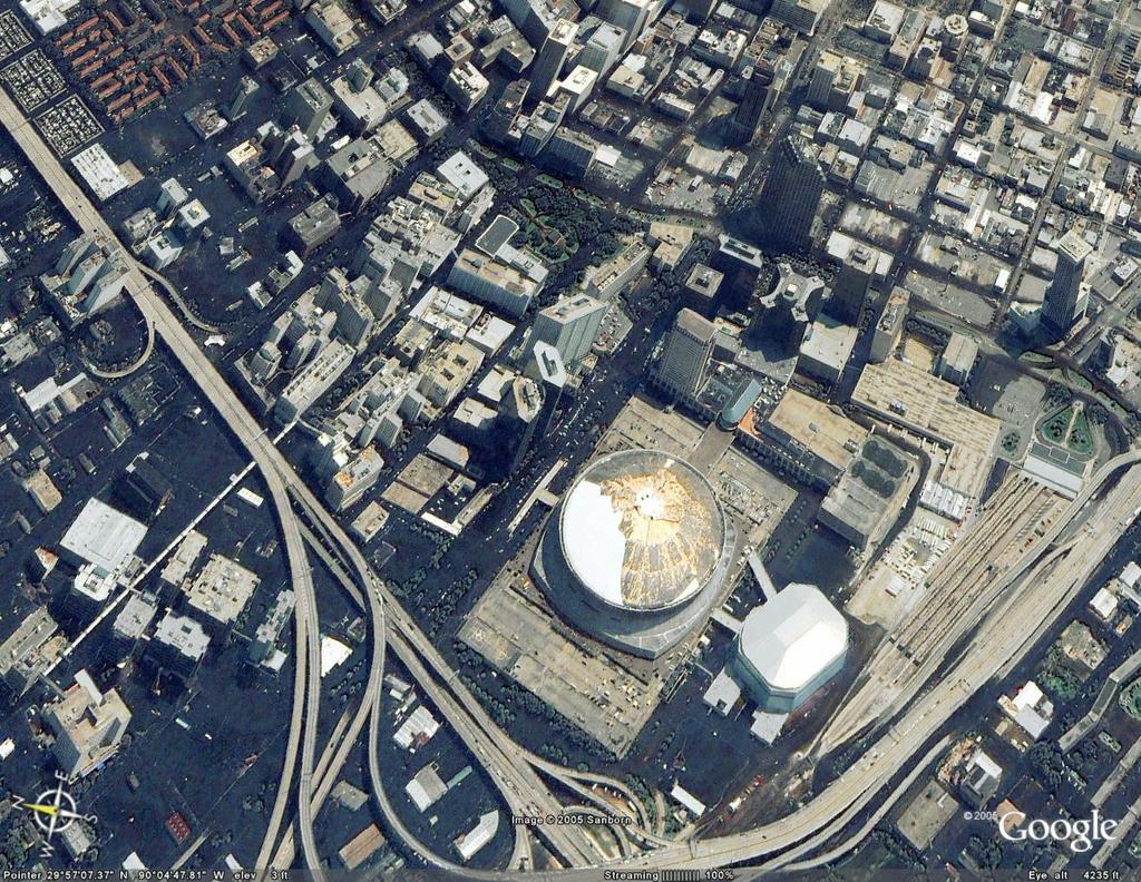
A natural disaster brings out the need for up-to-the-minute maps and images, and Google Earth community members have created more than 100 overlays in the last 24 hours that tell the story of Hurricane Katrina's effect. These overlays drape on top of existing satellite images, and NOAA has been posting these flyovers so people can actually see the incredible devastation.
If you don't already have Google Earth, download it to see some of the overlays that illustrate the change from previous images to the way things are now. Click on any of the overlays, which will open the application.
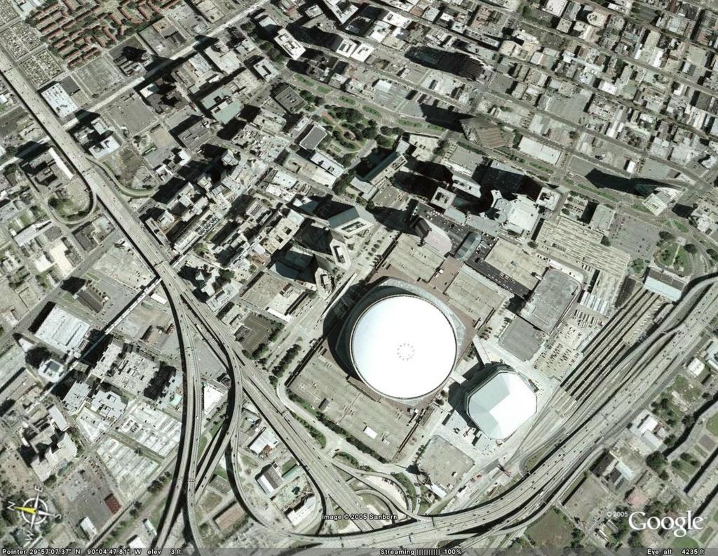
Here's an aerial "before" image of the Superdome area.
When you're in Google Earth, use the slider function at the bottom of your Places on the lefthand side (shown in this screen grab) to move the image from the left (before) to the right (after). More viewing and navigating help is here.
When you use the slider, much of what was light before is now dark -- with water.
We hope you'll find all the images useful. Please note you'll need a good video graphics card to handle the graphics.
UPDATED: Clarification on seeing the Google Earth images.
No comments:
Post a Comment