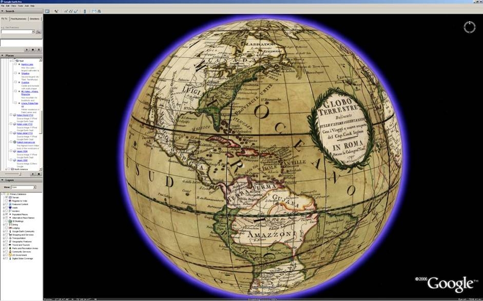
This morning was incredibly exciting for me: when I opened up Google Earth, there were 16 of my historic map treasures floating serenely on the Google Earth globe. After months of hard work, the Google Earth team uploaded all the maps this weekend to the Featured Content layer of Google Earth. I was able to explore and fly around the old maps and use the transparency slider to compare the old world and the new; as I did this, I thought to myself that this is the perfect marriage of historic cartographic masterpieces with the innovative contemporary software tools of Google.
It has been a real pleasure for me to work on this project with the Google Earth team, including John Hanke, Rebecca Moore, Wei Luo, Mark Aubin and many others who did the work to make this happen. I have been impressed with the dedication of these people to the power of maps and using the Internet to improve geographic knowledge and literacy -– and now we can add history to that as well.
The cartographers and explorers who made these historical maps hundreds of years ago would be amazed and thrilled to see their maps in Google Earth. For me it is a perfect example of creative reuse of historic materials that the Web, thanks to Google, is making possible. Now anyone using Google Earth can experience the same wonder that I have had as I collected and explored these old maps in my private library –- for me it is really exciting to share this with the world using Google’s tools.
I had a lot of great moments in building my collection of more than 150,000 historic maps over the last 25 years, but this morning waking up to seeing those 16 historic maps in Google Earth will rank as one of the most memorable.
No comments:
Post a Comment